The Brief
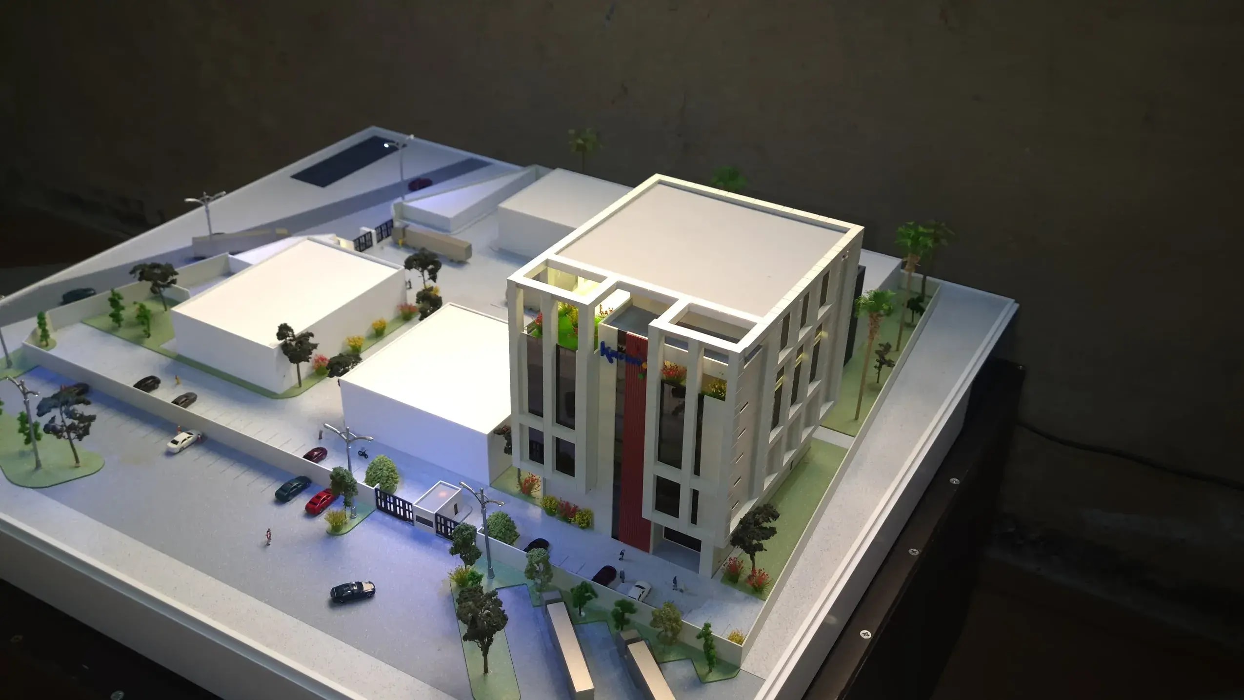
A real estate developer in Nigeria had submitted a planning application for a large mixed-use development — a scheme comprising residential towers, commercial ground-floor retail, a central public plaza, and underground parking across a multi-block urban site. The planning authority had requested a physical scale model of the development in its urban context as part of the submission review process.
The challenge was scale and complexity. The development site encompassed multiple city blocks, with the proposed scheme needing to be shown in relationship to significant existing buildings, road infrastructure, and a waterfront edge. At a scale that made the relationships legible to a planning committee, the model footprint would be substantial.
The commission to ODK Models: a 1:500 urban context model showing the full development and its immediate surroundings, produced to planning submission standards — accurate, legible, and durable enough to withstand repeated handling during committee meetings.
Model Specification
| Scale | 1:500 |
| Base Dimensions | 2400mm × 1600mm (two-section, joinable) |
| Proposed Development | White acrylic — all buildings, towers, retail podium, plaza |
| Existing Context Buildings | Grey acrylic and painted MDF — surrounding built environment |
| Terrain & Ground Plane | CNC-milled MDF, painted to distinguish road surfaces, pedestrian zones, water |
| Road Network | Painted surfaces with printed lane markings |
| Waterfront | Clear resin over blue-painted base |
| Transport | Two-section model with alignment guide for transport and reassembly |
| Production Time | 10 weeks |
The Technical Challenge: Context at Scale
Planning authority models differ from sales gallery models in one critical respect: the context must be as accurate as the proposed development itself. A sales gallery model can stylise the surrounding landscape and show simplified neighbouring buildings. A planning model must show the real built environment — the heights, massing, and proximity of existing buildings — so that the committee can make an informed judgement about the proposed development's impact on its surroundings.
This required our digital preparation team to work from both the architect's drawings and publicly available data on surrounding buildings — cross-referenced against survey measurements and satellite imagery — to construct accurate massing representations of the existing context. Every existing building shown in the model was verified against its actual height and footprint before fabrication began.
The proposed development was rendered in white acrylic throughout — a deliberate choice to distinguish it clearly from the grey-finished context buildings, allowing committee members to read the proposal against its surroundings without ambiguity.
Engineering the Two-Section Base
At 2400mm × 1600mm, a single-section base would have been impractical to transport through standard doorways and stairwells to the planning authority's meeting room. We engineered the model in two precisely-aligned sections with a mechanical connection system — steel dowels and receiving channels — that allowed the model to be disassembled for transport and reassembled on-site in under fifteen minutes without any visible join line or misalignment.
This two-section engineering was a critical detail. The model was transported to the planning committee meeting, set up in the committee room, and reviewed over three hours by committee members who examined it closely from multiple angles. The section join was invisible under normal viewing conditions.
The Planning Committee Review
The model was presented to the planning committee alongside the standard drawing package, design and access statement, and environmental impact assessment. According to the developer's architect, the model had a transformative effect on the committee's engagement with the application:
"Committee members who had struggled to read the drawings immediately understood the scheme when they saw the model. The questions shifted from 'what does this mean?' to 'how does this relate to the building next door?' — which is exactly the question we needed them to be asking."
The committee requested that specific views from the model be photographed and included in the meeting minutes. The model remained on display in the committee room for the full three-hour session, with members returning to it repeatedly during discussion of specific aspects of the scheme.
The Outcome
Planning approval was granted at the committee meeting, subject to standard conditions. The developer's planning consultant noted that the physical model had been a significant factor in the committee's ability to understand and evaluate the proposal — reducing the ambiguity that typically extends planning discussions and occasionally results in deferral for further information.
Following the planning approval, the model was retained by the developer and used in a subsequent investor presentation to secure equity funding for the construction phase. The same model that was built to satisfy a planning requirement became a commercial asset in the development's fundraising process.
Key Lessons for Developers
- Commission the model early in the planning process, not as a last-minute addition to the submission package. A model that is ready when the planning authority requests one — rather than produced reactively — demonstrates developer readiness and professionalism.
- Accuracy in context matters. A planning model that misrepresents surrounding building heights or proximity will be challenged by committee members with local knowledge. Invest in accurate context representation.
- Design for multiple uses. A model built for planning can often serve investor, sales, and PR functions subsequently — amortising the production cost across multiple uses in the development lifecycle.
- Consider transport from the start. Large-format models need to travel. Discuss transport engineering with your model maker at the brief stage, not after fabrication.